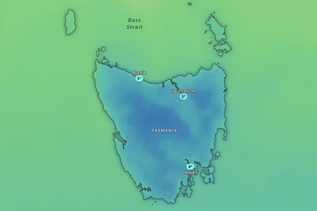
A cold front is sweeping across Tasmania this afternoon, bringing snow to low levels and icy southerly winds that will linger into Monday.
The Bureau of Meteorology is warning of snow falling to around 700 metres in southern areas this evening, dropping further to about 500 metres by Monday morning.
Showers are expected to develop across the south and east later on Sunday, with the chance of a thunderstorm around King Island.
Rain and showers will also affect the Bass Strait islands and northern districts throughout the day.
The bureau said westerly winds would ease as a low-pressure system moved over the southern mainland during Sunday.
“Later today, a cold front will move over southern and eastern Tasmania, bringing a cold southerly airstream into Monday,” it said.
Monday will be the coldest day of the week for many, with showers continuing in the south and east.
Small hail is possible in some southern areas as the chill southerly winds hold firm.
The rest of the state will remain mostly fine despite the cold conditions.
Relief is on the way from Tuesday, when a high-pressure system moves over the state, bringing clearer skies, lighter winds and afternoon sea breezes.
Wednesday will deliver similar weather, though a few light showers may brush the south-west.