
Tasmanians are being urged to batten down the hatches ahead of Christmas Eve, with damaging wind gusts of up to 100km/h expected to sweep across much of the state.
The Bureau of Meteorology has issued a severe weather warning as a cold front approaches from the west.
The system is expected to move through overnight and into Wednesday morning, bringing west to southwesterly winds averaging 50 to 60km/h.
Elevated areas will cop the worst of it first, with damaging gusts possible from Wednesday morning.
The wild weather is then expected to spread more widely through showers during the afternoon.
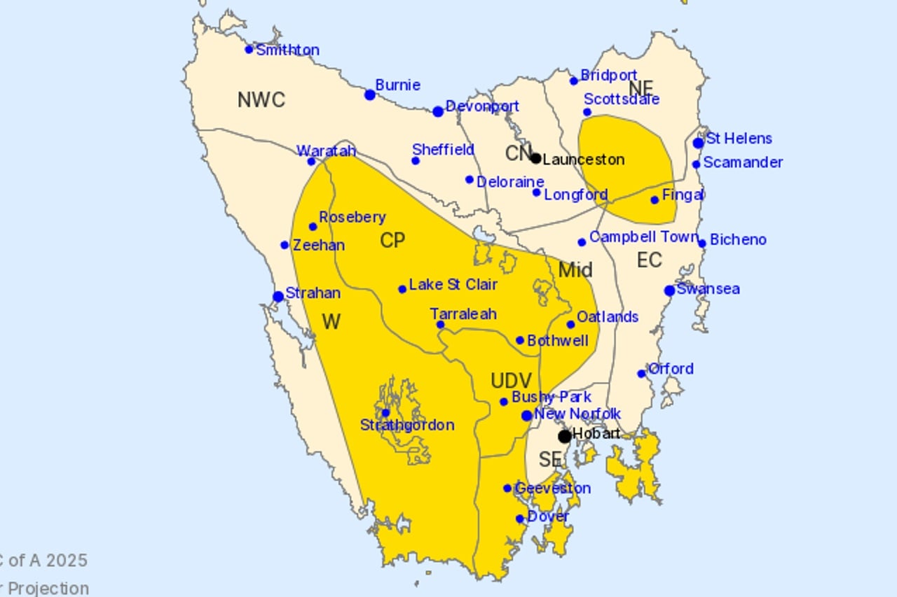
Towns in the firing line include New Norfolk, Oatlands, Whitemark, Bothwell, Geeveston and Dover.
Conditions should ease by Wednesday evening as the front pushes into the Tasman Sea.
In Hobart, Christmas Eve will bring a shower or two with winds of 30 to 45km/h and a top of just 16 degrees.
Burnie is in for the strongest winds, with gusts of up to 50km/h expected during the morning.
Launceston is in for only a slight chance of a shower and a top of 18 degrees.
Christmas Day will remain unsettled across the state, with Hobart expecting showers and possible small hail along with a cool top of 15 degrees.
A high fire danger rating is in place for both Hobart and Launceston on Christmas Day, with UV levels reaching extreme in the north.
The Boxing Day forecast shows mainly fine conditions and temperatures climbing to 18 degrees in Hobart and 21 degrees in Launceston.