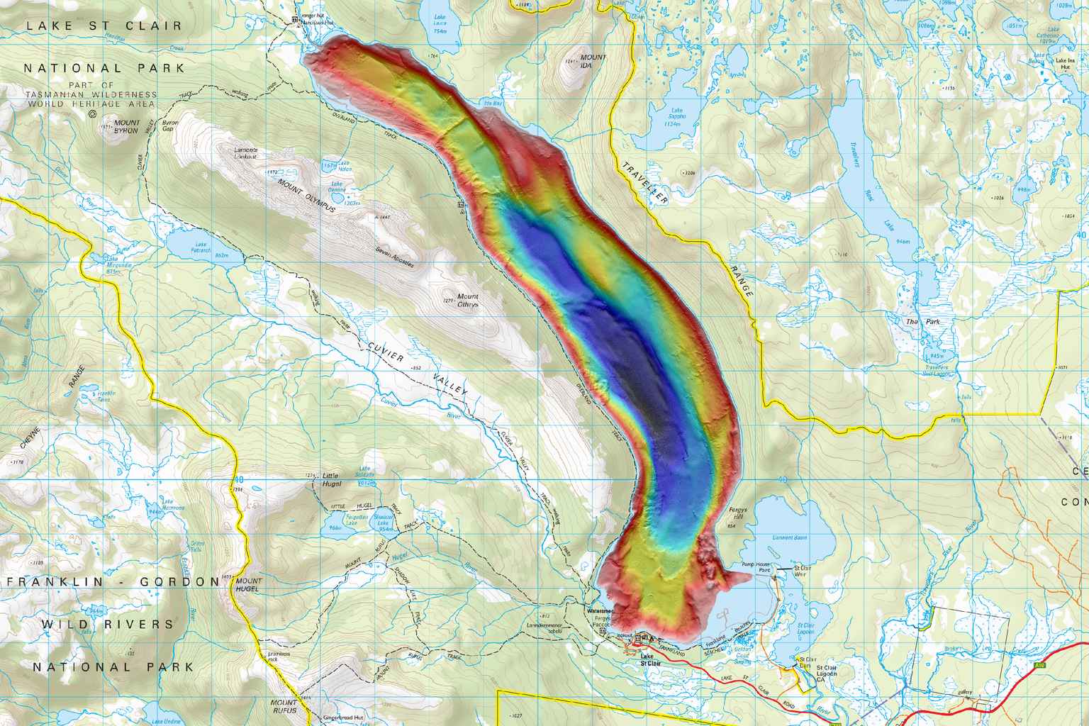
Scientists have solved a long-standing mystery about Tasmania’s Lake St Clair, confirming it as Australia’s deepest lake at 163 metres – nearly twice the depth of Bass Strait.
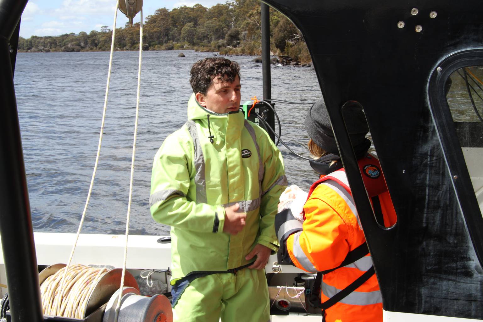
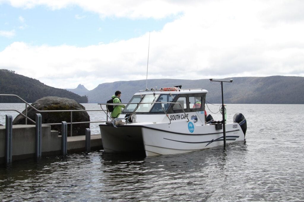
A team from CSIRO, Australia’s national science agency, has completed the first high-resolution 3D mapping of the iconic lake.
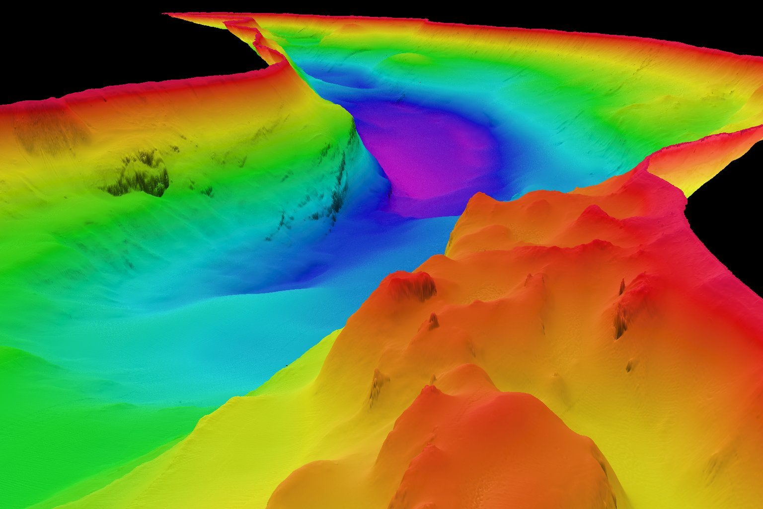
The work revealed dramatic underwater features including steep cliffs, deep ravines and towering rock formations.
It confirms Lake St Clair, located in Tasmania’s central highlands within the UNESCO World Heritage Cradle Mountain-Lake St Clair National Park, is substantially deeper than previously verified Australian lakes.
“Our mapping confirms that Lake St Clair is absolutely Australia’s deepest lake, with the next deepest lake being less than 100 meters deep,” said CSIRO hydrographic surveyor Augustin Déplante.
“We found Lake St Clair’s deepest point is close to the western shore on the bend in the lake about four kilometres north of the visitor centre, but there are several areas where the lake depth reaches 150 metres.”
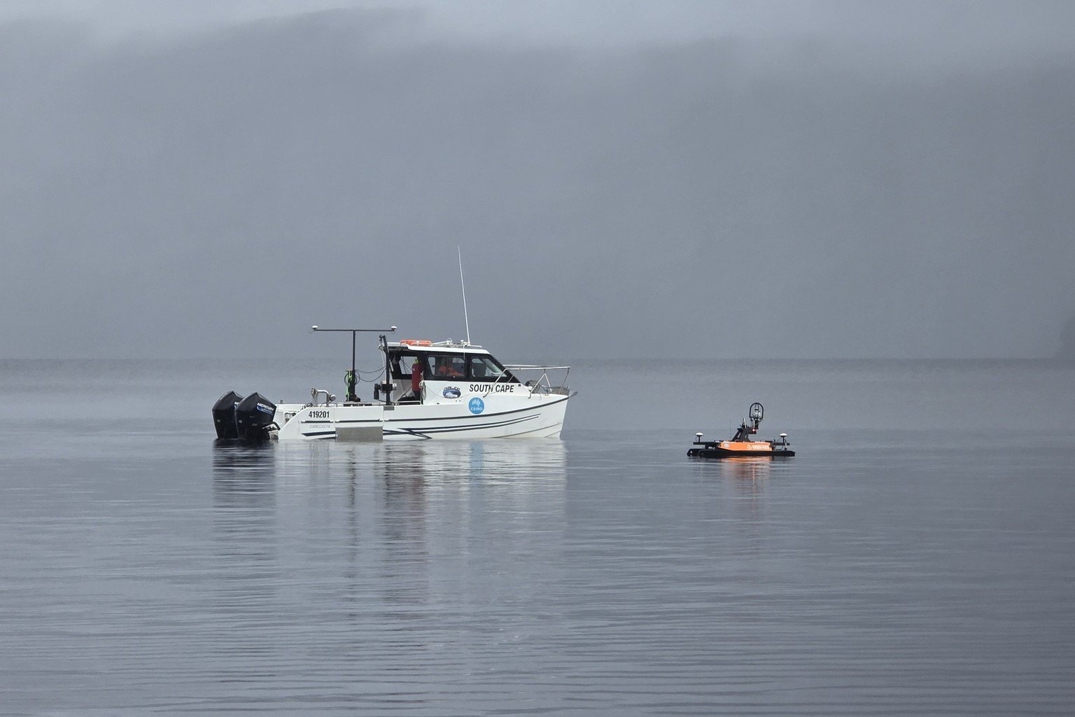
The eight-day project employed advanced multibeam sonar technology, battling wild weather conditions to systematically chart the ancient glacier-carved lake.
Researchers used two vessels: the eight-metre twin-hulled research vessel RV South Cape and a two-metre unmanned vessel called the Otter, which accessed shallower areas and used LIDAR technology to map the shoreline.
“The mapping is highly detailed and can identify objects as small as 50 centimetres in some places,” Déplante said.
“While the data does not confirm the presence of a Lake St Clair ‘Loch Ness’ monster, it does offer a powerful new tool for exploring the lake’s hidden depths.”
The 3D dataset will be shared with various stakeholders to support research into the lake’s underwater habitats and formation, while also assisting with safe navigation and testing of autonomous underwater vehicles.
The project was led by CSIRO’s Engineering and Technology Program in Hobart, with support from the Autonomous Sensors Future Science Platform, using Norbit multibeam systems provided by Seismic Asia Pacific.