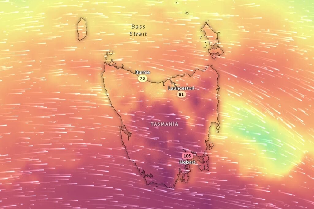
Tasmanians are in for another bout of wild weather today, with damaging winds set to lash much of the state before easing this evening.
The Bureau of Meteorology has issued a severe weather warning for damaging westerly winds as another cold front sweeps across Tasmania.
Elevated terrain and exposed southern areas are likely to cop winds averaging 65 to 75km/h, with peak gusts around 115km/h from late morning.
The rest of the state, including Hobart, can expect winds averaging 55 to 65km/h with gusts up to 100km/h during the afternoon.
The warning follows a blustery 24 hours that saw Maatsuyker Island record gusts of 135km/h, Scotts Peak hit122 km/h and Mount Wellington reach 120km/h.
Winds are expected to ease below warning thresholds by Monday evening.
“Conditions will be much calmer on Tuesday before rain spreads across the state on Wednesday,” the bureau said.
“Winds will be much lighter than what we saw over the weekend.”
Forecast for the rest of Monday
Showers mainly about the west and far south, falling as snow to 900 metres in the south. Mostly fine elsewhere. Fresh to strong and gusty westerly winds.
Tuesday 21 October
Mostly fine apart from light showers about the west. Westerly winds.
Wednesday 22 October
Showers statewide. Light winds, tending south to southwesterly late.
Thursday 23 October
Showers mainly about the west and far south, falling as snow to 800 metres. West to southwesterly winds.