The Bureau of Meteorology has issued a severe weather warning for damaging winds across all of Tasmania, with gusts potentially hitting 120km/h in some areas this Saturday.
A strong cold front is forecast to sweep across the state from mid-morning tomorrow, bringing north-westerly winds averaging 55 to 70km/h, with gusts around 100km/h expected in many regions.
The system will first hit the West Coast before moving through the central districts by mid-afternoon, tracking east by evening.
Western and north-western coastal areas, including King Island, are in for the worst of it, with peak gusts potentially reaching 110km/h, along with showers and possible thunderstorms.
The bureau says the strongest winds are likely over elevated areas above 1,000 metres, such as the Central Plateau and Cradle Mountain region.
Winds there could average 70 to 80km/h, with gusts up to 120km/h.
Hobart and Launceston are set to feel the impact on Saturday afternoon as the front pushes east.
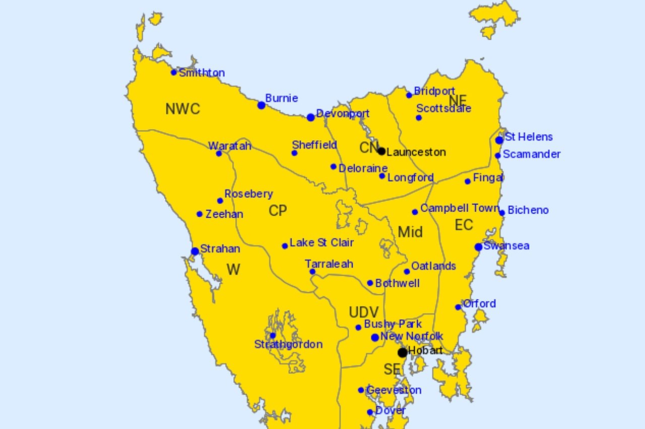
Other locations in the warning area include Devonport, Burnie, St Helens, Swansea, Strahan, New Norfolk, Currie, Smithton, Oatlands and Scottsdale.