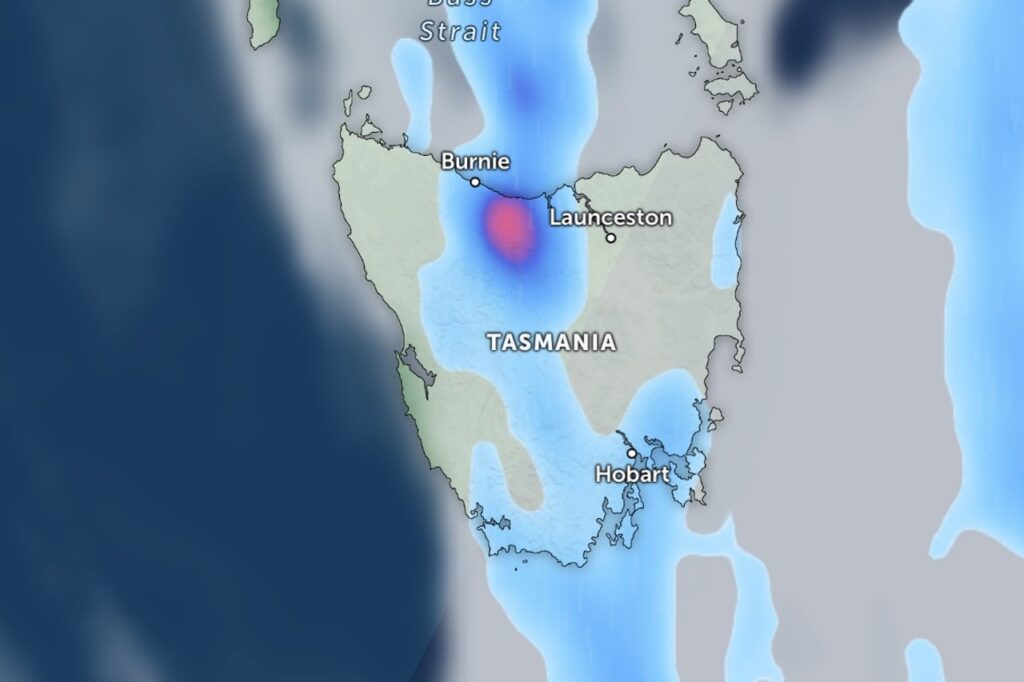
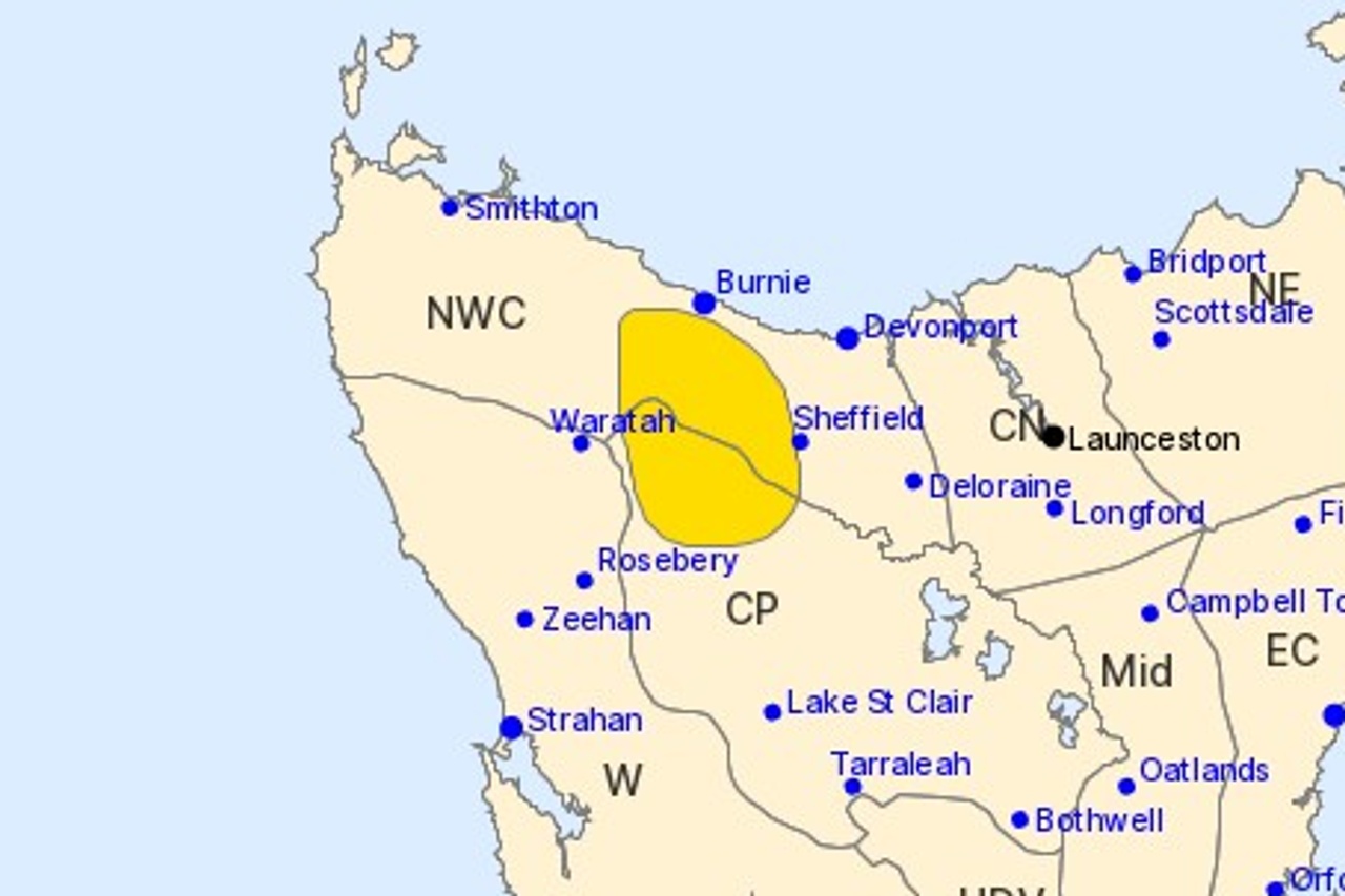
A severe thunderstorm warning is in place for parts of Tasmania’s north-west coast and Central Plateau, with heavy rainfall already lashing the area south of Burnie.
The Bureau of Meteorology issued the warning just after 4pm on Sunday.
It covers a zone stretching from Burnie down through Sheffield, Waratah and Rosebery.
“Severe thunderstorms are likely to produce heavy rainfall that may lead to flash flooding in the warning area over the next several hours,” the bureau said.
Forecasters say a slow-moving surface trough sitting in a moist airmass is to blame for the persistent rain and showers across the state’s north-west.
“A slow moving surface trough within a moist environment is producing a line of persistent rain and showers in the northwest of the state,” the bureau said.
The wet weather is expected to linger through the afternoon before easing in the early evening.
The broader pattern is being driven by a slow-moving high pressure system near New Zealand, which is pushing a mild north to north-easterly airstream over Tasmania.
Conditions should settle on Monday, with light showers confined to the east and south and mainly fine weather elsewhere.
A weak cold front is then forecast to approach the west on Monday before crossing the state on Tuesday, bringing renewed showers to western districts.