Heavy rain is still hammering eastern Tasmania, with some areas already copping more than 70 millimetres in 24 hours and forecasters warning totals could top 100 millimetres before midnight.
The Bureau of Meteorology’s Kate Doyle said Gray, south of St Marys, recorded 72.6 millimetres in the 24 hours to 9am on Wednesday, making it the standout total across the state.
Nugent near Sorell picked up 58.4 millimetres and Longley south of Kingston had 56.2 millimetres.
Hobart’s Kunanyi/Mount Wellington came in at 53.4 millimetres, while Fern Tree at the foothill of the mountain recorded 55.8 millimetres
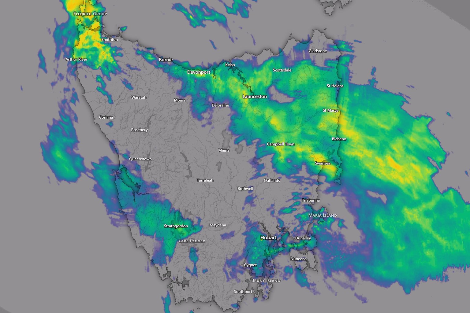
“Certainly some big numbers across much of the east of Tasmania to 9am and we of course are continuing to see the rainfall,” Doyle told Pulse.
She said the rain was being driven by a low-pressure system over the south-east mainland, which is extending a trough south over Tasmania and dragging very moist air across the state.

A weaker low that has developed in Bass Strait is also tapping into that moisture, bringing solid rainfall to the northeast and east coast.
Doyle said the heaviest falls on Wednesday were expected across the north-east and central east of Tasmania, where 30 to 60 millimetres could fall during the remainder of the day.
“We could even see some isolated higher totals above eighty millimetres across higher terrain,” she said.
“So places like St. Mary’s and Gray could receive over a hundred millimetres before midnight tonight.”
For the rest of the eastern half of the state, 10 to 30 millimetres is still broadly expected on Wednesday, with higher falls across elevated areas and less than 10 millimetres in the west.
“Very much an east coast situation this time around,” Doyle said.
Conditions should start easing from Thursday morning with the low expected to weaken and the trough carrying tropical moisture should shift east.
Conditions are then expected to improve further heading into Friday.