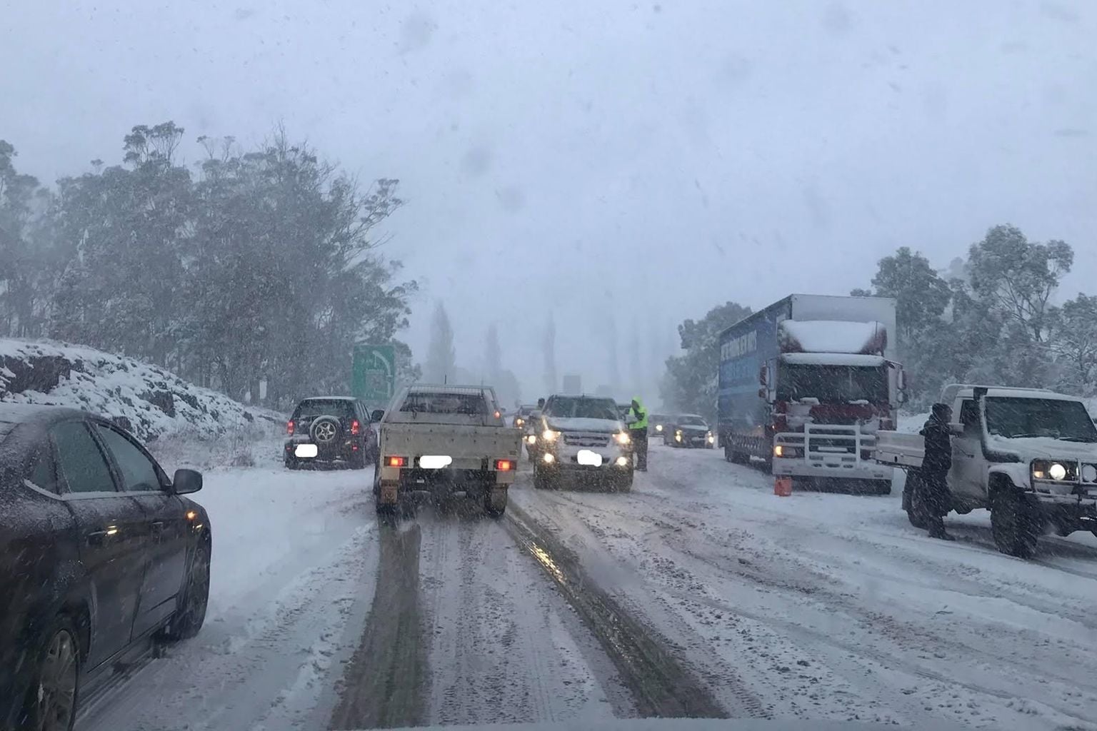
Parts of Tasmania are being hit by rain and strong winds today, ahead of thunderstorms and snow forecast to sweep the state later in the week.
The Bureau of Meteorology recorded wind gusts of 82km/h at Mount Read in the west by mid-afternoon on Wednesday.
Kunanyi/Mount Wellington reached 57km/h, while King Island and Cape Grim both recorded gusts of 54km/h or higher.
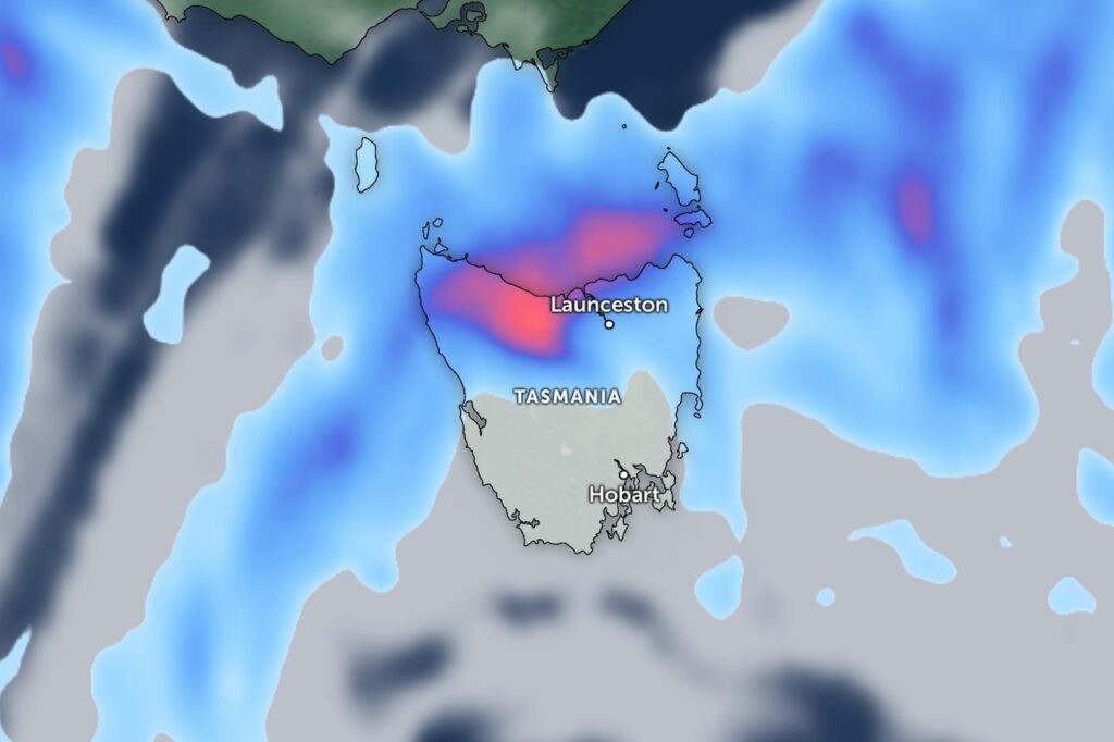
The heaviest rain has stayed in the north and west. Marrawah, on the far north-west tip, recorded 12mm from 9am, while Liawenee on the Central Plateau collected 8.2mm.
Lowland temperatures have been mild, with Flinders Island reaching 16.9 degrees, Strahan 16.3 degrees and Launceston 15.8 degrees.
Hobart topped out at just 13.3 degrees, while kunanyi/Mount Wellington was sitting at 4.2 degrees late in the afternoon, feeling like minus 5.2.
The conditions line up with forecasts pointing to a wet and snowy week ahead.
The bureau expects the heaviest falls in the central north and west, with some areas tipped to receive up to 100 millimetres by Saturday.
Meteorologist Daniel Sherwin-Simpson this week told Pulse isolated exposed sites such as Mount Read and Cradle Mountain could receive up to 150mm.
A cold front is due to cross the state on Thursday, bringing gusty winds and the chance of thunderstorms across northern and western coastal areas.
Snow levels are then set to drop to around 500 metres in the south once the front clears on Friday.
The bureau currently has seven warnings in place for Tasmania.